Government Introduces Digital Crop Survey Initiative
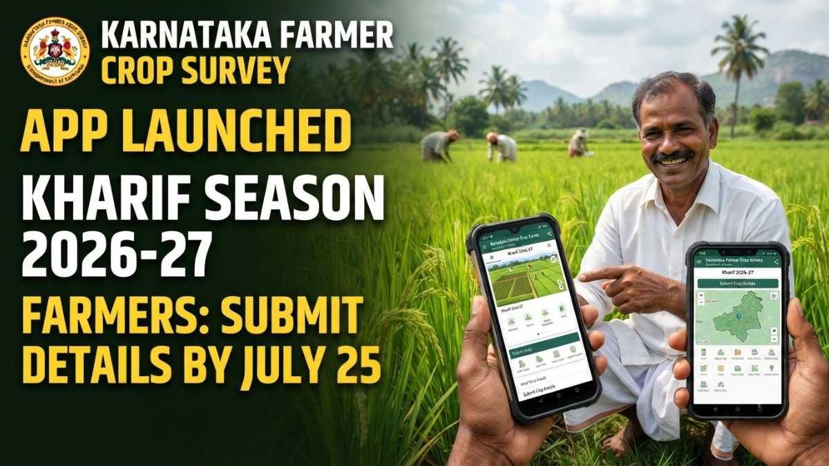
The Department of Agriculture, Government of Karnataka, has launched a mobile application named “Kharif Farmer Crop Survey 2026-27” to enable farmers to independently record and submit details of crops cultivated on their agricultural land during the 2026-27 monsoon (Kharif) season.
The initiative has been introduced under the slogan “My Crop, My Right”, encouraging farmers to take direct responsibility for updating information about the crops grown on their fields. Through this digital platform, farmers can upload crop-related information using their smartphones without depending on field officials for the initial survey process.
The department has announced that July 25, 2026, is the last date for farmers to complete and submit their crop survey details through the application. Farmers are advised to finish the process within the prescribed period to ensure their records are updated accurately in government databases.
Purpose of the Crop Survey Application
The newly launched mobile application aims to create an accurate and up-to-date database of crops cultivated across Karnataka. The information collected through the app will help the government:
- Identify crop patterns across districts.
- Plan agricultural support programs effectively.
- Facilitate crop insurance and compensation schemes.
- Verify crop cultivation details for loans and subsidies.
- Improve transparency in government welfare programs.
By allowing farmers to enter their own data, the government expects greater accuracy in crop records and faster processing of agriculture-related benefits.
How Farmers Can Download the Application
Farmers can download the application directly from the Google Play Store.
Steps to Download
- Open Google Play Store on your Android smartphone.
- Search for “Kharif Farmer Crop Survey 2026-27” or the officially notified crop survey application.
- Download and install the application.
- Alternatively, farmers may scan the QR code provided in official department notifications to access the application directly.
After installation, the application must be activated through Aadhaar-based verification before crop details can be entered.
Aadhaar Authentication and e-KYC Process
To use the application, farmers who possess a FRUITS Identification Number (FID) must complete Aadhaar-based authentication.
Step-by-Step Aadhaar Verification
- Open the application.
- Select the option for e-KYC Aadhaar Authentication.
- Enter your Aadhaar number.
- Click on the option to generate an OTP.
- A six-digit OTP will be sent to the mobile number linked with Aadhaar.
- Enter the OTP in the application.
- Next, provide your mobile number.
- A separate mobile OTP will be sent.
- Enter the mobile OTP to complete the verification process.
Once both verifications are completed successfully, the application becomes active and ready for use.
Linking Survey Numbers to Farmer Records
After login, land records associated with the farmer’s FID are automatically retrieved from the government database.
However, in some cases, certain survey numbers may not appear in the application. Farmers need not worry, as the app provides an option to add missing land details manually.
How to Add a Survey Number
- Select the “Add Survey Number” option.
- Choose the relevant:
- District
- Taluk
- Hobli
- Village
- Enter the survey number.
- Click on the option to retrieve land information.
- Verify ownership details displayed on the screen.
- Download or save the survey information.
This feature ensures that all land parcels cultivated by the farmer are properly linked before crop information is uploaded.
Entering Crop Information in the Field
One of the most important requirements of the crop survey process is that farmers should physically visit their agricultural land while recording information.
The application is designed to capture real-time data from the actual cultivation site.
Information That Must Be Recorded
For each survey number and subdivision (hissa number), farmers should enter:
- Name of the crop cultivated.
- Area covered under each crop.
- Total cultivated extent.
- Details of mixed or multiple crops, if applicable.
The information should accurately reflect the actual conditions on the ground.
Providing incorrect details may affect eligibility for various agricultural benefits in the future.
Reporting Non-Cultivated Areas
The crop survey does not only focus on cultivated land.
Farmers must also record portions of their land that are being used for non-agricultural purposes or are not under cultivation.
Examples include:
- Houses or farm buildings.
- Roads passing through the property.
- Wells and water structures.
- Streams and drainage channels.
- Rocky areas.
- Fallow land.
- Bunds and embankments.
Recording these details helps authorities obtain a realistic picture of land utilization and crop coverage across the state.
Uploading Geo-Tagged Crop Photographs
After entering crop details, farmers must upload photographs of their crops through the application.
Photo Requirements
- A minimum of two photographs should be uploaded for each major crop.
- The photographs must be taken directly from the application whenever possible.
- Images should clearly show the crop condition.
- GPS location must be enabled on the smartphone during photo capture.
The geo-tagged photographs serve as visual proof of cultivation and help verify the authenticity of crop records.
This feature also reduces the chances of incorrect reporting and improves transparency in government schemes.
Final Submission of Crop Survey Data
Once all information has been entered and photographs uploaded, farmers should carefully review every detail before submission.
Before Uploading
Check the following:
- Survey number details are correct.
- Crop names are accurate.
- Area measurements are properly entered.
- Non-cultivated areas are recorded.
- Photographs have been uploaded successfully.
After verification, click the upload button to submit the information to the agriculture department database.
Upon successful upload, the crop survey process is considered complete.
Last Date for Submission
The Department of Agriculture has clearly stated that July 25, 2026, is the final date for farmers to upload their crop details through the mobile application.
Farmers are encouraged not to wait until the last moment because:
- Server traffic may increase near the deadline.
- Technical issues could delay submissions.
- Missing information may require corrections.
Completing the process early allows sufficient time to resolve any errors.
What Happens After the Deadline?
According to departmental guidelines, once the farmer self-reporting period ends, crop surveys may be carried out through designated field personnel or authorized survey staff.
However, self-reporting through the application gives farmers greater control over ensuring that the information recorded matches the actual crop grown on their land.
Therefore, farmers are strongly encouraged to complete the survey personally before the deadline.
Why Is the Crop Survey Important?
The crop survey plays a vital role in several agricultural programs and government services. The data submitted through the application becomes an official record of cultivation for the season.
Below are some of the major benefits associated with timely crop survey submission.
1. Access to Crop Loans
Financial institutions often require proof of cultivation before approving agricultural loans.
The crop survey serves as an important source of verification because it records:
- Type of crop cultivated.
- Extent of cultivation.
- Land ownership and usage details.
Banks and cooperative societies may use this information while processing crop loan applications.
Accurate crop records can improve access to institutional credit and reduce dependency on informal borrowing sources.
2. Crop Insurance Benefits
Crop insurance programs are designed to protect farmers against losses caused by:
- Drought.
- Floods.
- Excess rainfall.
- Pest attacks.
- Natural calamities.
When a farmer files an insurance claim, authorities need evidence of the crop cultivated in the affected area.
The crop survey data serves as an official record for this purpose.
Only crops properly recorded in the survey are generally considered during claim verification and settlement processes.
Therefore, updating crop details accurately is extremely important for insurance protection.
3. Eligibility for Minimum Support Price Procurement
The government procures certain agricultural commodities from farmers under Minimum Support Price (MSP) schemes.
Examples include:
- Paddy.
- Ragi.
- Maize.
- Other notified crops.
Before procurement, authorities often verify cultivation details through official databases.
Crop survey records help establish that the farmer has actually cultivated the crop being offered for procurement.
Accurate survey information can therefore facilitate smoother registration and procurement processes.
4. Disaster Relief and Input Subsidies
During severe droughts, floods, cyclones, or other agricultural disasters, governments may announce relief packages and input subsidies.
To identify eligible beneficiaries, authorities rely on verified crop cultivation records.
Crop survey data helps determine:
- The crop grown.
- The area affected.
- The extent of potential loss.
As a result, compensation and subsidy payments can be transferred directly to eligible farmers through Direct Benefit Transfer (DBT) systems.
Without proper crop records, receiving such assistance may become difficult.
5. Accurate Land and RTC Records
The information submitted through the crop survey contributes to maintaining updated agricultural records.
It helps ensure that official land documents reflect:
- Crops cultivated during the season.
- Agricultural activities carried out on the land.
- Land-use patterns.
Such records can be useful for future agricultural planning, legal verification, and various government services connected with farming activities.
Consequences of Not Uploading Crop Details
The agriculture department has cautioned farmers against ignoring the crop survey process.
Failure to submit crop information may affect access to several government-supported benefits and schemes.
Potential impacts may include difficulties in:
- Availing crop insurance benefits.
- Accessing agricultural subsidies.
- Receiving disaster compensation.
- Obtaining support under crop procurement programs.
- Benefiting from schemes offered by agriculture, horticulture, and sericulture departments.
- Accessing assistance for agricultural equipment and farm mechanization programs.
Because many government services increasingly rely on digital verification systems, maintaining updated crop records has become more important than ever.
Farmers Are Encouraged to Complete the Survey Early
The self-reporting crop survey initiative represents a major step toward digitizing agricultural records and empowering farmers.
By using the mobile application, farmers can directly record cultivation information, upload evidence from their fields, and ensure that official records accurately reflect their farming activities.
With the submission deadline fixed at July 25, 2026, farmers are advised to complete the process well in advance. Accurate and timely reporting can help secure access to loans, insurance, subsidies, procurement programs, and other important government benefits throughout the agricultural season.
The Department of Agriculture has urged all eligible farmers to make full use of the application and ensure that their crop information is updated correctly before the closing date.