Finding land survey numbers, identifying property boundaries and accessing agricultural land information have become much easier for people in Karnataka. With the introduction of digital land information services, citizens no longer need to depend entirely on traditional methods or visit government offices for every basic land-related enquiry.
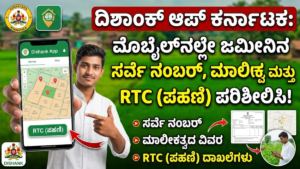
One such useful digital platform is the Dishaank App, an application designed to help people identify land parcels, view village survey maps and explore geographical information using their smartphones.
Developed under the Karnataka GIS (K-GIS) initiative, the application uses digital mapping technology and GPS facilities to help users locate survey numbers based on their geographical position. It can be particularly helpful for farmers, agricultural landowners, property buyers and anyone interested in understanding land details in Karnataka.
Whether you want to identify the survey number of your agricultural field, examine nearby land parcels or view available cadastral maps, Dishaank offers a convenient starting point.
In this article, we explain what the Dishaank App is, its major features, how to download and use it, how it relates to Karnataka’s Bhoomi land records system and what precautions users should take before making property-related decisions.
What Is the Dishaank App?
Dishaank is a geographical information application developed by the Karnataka State Remote Sensing Applications Centre (KSRSAC) as part of the Karnataka Geographic Information System programme.
The main purpose of the application is to make geographical land information more accessible to ordinary citizens through digital maps and location-based services.
Traditionally, identifying a particular agricultural land parcel required knowledge of its village, survey number and surrounding geographical features. In many situations, people had to depend on local records, village maps or assistance from government officials.
Dishaank simplifies the initial identification process by bringing digitised survey maps and GPS technology together.
After opening the application and allowing location access, users can view their current position on the available digital map. Where suitable survey mapping data is available, the application can help identify the survey number associated with that location.
The platform also provides access to geographical information about land parcels, including cadastral boundaries and available subdivision details.
It is important to understand that Dishaank is primarily a mapping and land-information tool. It should not be considered a replacement for official ownership certificates, registered property documents or legally certified survey records.
Main Features of the Dishaank App in Karnataka
The application offers several useful facilities for people who need basic geographical information about land in Karnataka.
1. Identify Land Survey Numbers Through GPS
One of the most useful functions of Dishaank is its location-based survey number identification facility.
Users can activate GPS on their smartphones and open the application to see their current geographical position on the map.
When the required digital survey information is available, the application can display the corresponding survey number of the land parcel.
This feature can help farmers identify agricultural fields, landowners locate their properties and property buyers understand the survey details of a particular location.
For accurate results, users should ensure that their mobile location settings are enabled and that they are viewing the correct geographical area.
2. Explore Land Ownership-Related Information
Understanding who owns a particular piece of land is an important part of property verification.
Dishaank can help users access available land-related information associated with mapped survey parcels and connected government records.
Depending on the available data and application functionality, users may be able to refer to information relating to land extent, survey identification and ownership-related details.
However, users should not assume that every ownership detail displayed or linked through a mapping application represents the latest legally recognised ownership.
For reliable ownership verification, citizens should obtain the latest Record of Rights, Tenancy and Crops (RTC) through Karnataka’s official Bhoomi services.
3. View Digital Village Survey Maps
Dishaank provides access to digitised geographical maps that help users understand the arrangement of land parcels within a village.
These maps are useful for identifying the approximate location of different survey numbers and understanding how neighbouring agricultural properties are positioned.
Instead of depending entirely on paper village maps, users can explore available digital representations using their mobile phones.
This can make preliminary land identification more convenient, particularly when visiting agricultural properties or unfamiliar villages.
4. Understand Hissa Numbers and Subdivided Land
Agricultural properties are sometimes divided into smaller portions because of inheritance, family settlements, property transactions or other legal arrangements.
When a survey number is subdivided, the resulting portions may be identified through separate Hissa numbers.
For example, a parent survey number may have subdivisions such as 45/1, 45/2 or 45/3.
These identifiers help distinguish different portions associated with the original survey number.
Where the relevant information is available, Dishaank can help users examine mapped subdivisions and understand the geographical arrangement of different land parcels.
For legal confirmation of a subdivision, however, users should consult the relevant official survey and revenue records.
5. Search Land Information Using Village Details
Users who are not physically present at the property location may still be able to explore available land information through the application’s search facilities.
Land-related searches can be based on administrative details such as:
- District name
- Taluk name
- Hobli name
- Village name
- Survey number
Selecting the correct village and entering the appropriate survey identification details can help users locate a particular land parcel on the digital map.
This is especially useful for people who want to examine agricultural property located in another part of Karnataka.
6. Access Different Map Viewing Options
Understanding the geographical position of land can be easier when users can examine it through different map presentations.
Depending on the available application version and map layers, Dishaank may provide different viewing options, including standard geographical maps, satellite imagery and terrain-related information.
Satellite imagery can help users recognise nearby roads, buildings, agricultural fields, water bodies and other geographical features.
Standard map views are useful for examining geographical locations and survey information.
These facilities make it easier to understand the surroundings of a particular property.
7. Measure Land Area and Distances
Land measurement is another useful requirement for agricultural property owners and people interested in purchasing land.
The application may provide geographical measurement facilities that allow users to estimate distances or areas directly on the map.
Such tools can help users understand the approximate size of a land parcel or measure the distance between selected geographical points.
However, measurements obtained through digital maps should be treated as estimates.
For official land measurements, boundary confirmation and legal documentation, users should contact the authorised land survey department.
8. Use Available Maps in Areas With Limited Internet
Internet connectivity may not always be reliable in rural areas, particularly when visiting agricultural properties located away from towns and major roads.
The application may offer map download or offline viewing facilities for supported geographical data.
Where offline map functionality is available, users can download the required information in advance and access supported map content without depending on a continuous internet connection.
The availability of offline features may vary depending on the application version and the selected map information.
How to Download the Dishaank App on Your Android Mobile
Downloading the Dishaank application is a straightforward process.
Android users can follow these instructions:
- Open the Google Play Store on your smartphone.
- Tap the search bar and enter Dishaank.
- Look for the application published by KSRSAC KGIS.
- Check the developer information to avoid installing an unrelated application.
- Open the official application listing.
- Tap the Install option.
- Wait until the installation process is completed.
- Open the application from your mobile screen.
- Allow the necessary location permissions when requested.
Users should download the application from a trusted source and verify the developer details before installation.
Official application: Dishaank – KSRSAC KGIS
Platform: Android
Download source: Google Play Store
Cost: Free to download, subject to the application’s current listing and terms.
How to Check Your Land Survey Number Using the Dishaank App
After installing the application, you can use its location-based facilities to identify available survey information.
Follow the steps below.
Step 1: Launch the Application
Open Dishaank on your Android smartphone.
Wait for the application to load its map interface and available geographical information.
Step 2: Enable Your Mobile GPS
Make sure your smartphone’s location service is switched on.
If GPS is disabled, the application may not be able to identify your current position accurately.
Step 3: Allow Location Permission
When the application requests permission to access your location, provide the appropriate permission if you want to use GPS-based identification.
Location access is necessary for identifying the geographical position of the land where you are standing.
Step 4: Open the Digital Map
Navigate to the map screen.
The application should display the available geographical information for the selected area.
If your location is enabled, look for the option that identifies or centres the map around your current position.
Step 5: Locate the Land Parcel
Zoom in on the map until the required land parcel becomes visible.
You may need to adjust the map position to identify the exact geographical area.
Step 6: Select the Required Location
Tap the relevant location or land parcel on the map, depending on the available application controls.
If the required cadastral information is available, the application may display its survey number and associated geographical details.
Step 7: Check the Available Land Information
Examine the information displayed on the screen.
Note the survey number and any available Hissa or other land identification details.
If you are checking property belonging to another village, use the available administrative search options to locate the correct district, taluk, hobli and village.
Step 8: Verify the Information Through Official Records
Once you have identified the survey number, cross-check it using the official Bhoomi land records portal.
This additional verification is important when the information is being used for property purchases, inheritance matters, agricultural loans or legal purposes.
What Is the Difference Between Dishaank and Bhoomi?
Many people become confused about the difference between Karnataka’s Dishaank application and the Bhoomi land records system.
Although both are associated with land information, their primary purposes are different.
Dishaank: Primarily helps users identify geographical land parcels, view digital survey maps and examine available survey boundaries through mapping technology.
Bhoomi: Provides access to official digitised land revenue records, including RTC information and other related services.
An RTC, also known as Pahani, is an important revenue document containing information such as the recorded landholder, land extent, land classification and cultivation-related details, subject to the records maintained by the revenue authorities.
If you want to identify where a survey number is located, Dishaank can be useful.
If you want to examine official revenue information associated with agricultural land, Bhoomi is the appropriate platform to consult.
Using both services together can make preliminary property research more convenient.
Who Can Benefit From the Dishaank Application?
The application can be useful for several groups of people across Karnataka.
Farmers: Agricultural workers and farmers can use digital maps to identify survey numbers and understand the geographical location of their fields.
Agricultural Landowners: Property owners can examine available cadastral maps and identify nearby survey parcels.
People Purchasing Land: Prospective buyers can use the application as an initial reference when checking the geographical identity of agricultural properties.
Property Developers: Developers can explore geographical information about land parcels before beginning preliminary planning activities.
Village Residents: People can use the application to understand available survey information relating to their village.
Real Estate Professionals: Property agents and consultants may find digital survey maps useful during preliminary property identification.
Students and Researchers: People studying geography, rural development and land administration may also find the mapping information helpful.
Important Precautions Before Buying Agricultural Land
Although Dishaank makes geographical land identification easier, using the application alone is not sufficient when purchasing agricultural land.
Property transactions involve legal ownership, revenue entries, registered documents and official boundary information.
Before purchasing a property, consider the following checks:
- Obtain the latest RTC or Pahani through the official Bhoomi platform.
- Verify the seller’s ownership through registered sale deeds and relevant previous title documents.
- Examine mutation records to understand changes recorded in the revenue department.
- Check whether the survey number and Hissa number match the property documents.
- Verify the land extent mentioned in the records.
- Examine whether any mortgage, court case, acquisition proceeding or other encumbrance affects the property.
- Confirm the property’s boundaries through authorised survey procedures whenever necessary.
- Consult a qualified property lawyer before completing the transaction.
A digital map is useful for geographical reference, but it does not independently establish legal ownership.
Similarly, the location shown through a mobile GPS facility may not always match the exact legal boundary of a property.
What Should You Do if the Survey Number or Boundary Information Is Incorrect?
Sometimes users may notice differences between the information shown on a digital map and the details mentioned in their property documents.
This can happen because of outdated mapping information, GPS accuracy limitations, data discrepancies or changes in land subdivisions.
If you encounter such a problem, do not assume that the digital map automatically represents the legally accepted boundary.
Instead, take the following steps:
- Recheck the district, taluk, hobli and village selection.
- Compare the survey number with the latest RTC.
- Examine the registered property documents.
- Check the relevant mutation and subdivision records.
- Approach the concerned Survey, Settlement and Land Records Department for official clarification.
- Request an authorised land survey if boundary confirmation is required.
For serious ownership or boundary disputes, seek professional legal assistance.
Frequently Asked Questions About the Dishaank App
1. What is the main purpose of the Dishaank App?
Dishaank is designed to help Karnataka residents explore geographical land information, identify survey numbers and view available digitised village survey maps using mobile technology.
2. Is the Dishaank App free?
The Android application is listed as a free-to-download application. Users should check the current Google Play Store listing for updated terms and availability.
3. Can I find my land survey number using GPS?
Yes. The application is designed to support GPS-based identification of land survey numbers where the relevant digital mapping information is available.
4. Can I check land ownership through Dishaank?
The application may provide access to available ownership-related land information. For authoritative ownership and revenue details, users should verify the latest RTC and other relevant documents through official government services.
5. Can I check agricultural land details in another village?
You can explore available land information by selecting the appropriate administrative location, such as district, taluk, hobli and village, and searching for the relevant survey number.
6. Does Dishaank provide Hissa details?
The application can help users explore available survey subdivisions and Hissa-related geographical information where supported by the underlying map data.
7. Can I use Dishaank without internet access?
Some versions or map services may support downloaded map information for offline reference. However, the availability of offline facilities depends on the application and the selected data.
8. Is the Dishaank map legally valid for property registration?
No. A map displayed in the application should not be treated as a substitute for legally recognised ownership documents or an official boundary survey.
9. What is the difference between a survey number and a Hissa number?
A survey number identifies a larger land parcel in the village revenue survey system. A Hissa number identifies a subdivision or separately recorded portion of that survey parcel.
10. Where can I verify Karnataka RTC records?
You can use the Karnataka government’s official Bhoomi land records services to access available RTC and related revenue information.
Dishaank App Download Link
Android users interested in exploring Karnataka’s digital land maps can search for the official Dishaank application on Google Play.
Application name: Dishaank – KSRSAC KGIS
Developer: KSRSAC KGIS
Platform: Android
Download: Google Play Store – Search for Dishaank
Always confirm that the application is published by the appropriate developer before installing it.
Conclusion
The Dishaank App is a useful digital mapping initiative that helps make geographical land information more accessible to people throughout Karnataka. By combining GPS technology with digitised village survey maps, it provides a convenient way to identify survey numbers, explore available cadastral boundaries and understand the location of agricultural land parcels.
Farmers can use it to examine their fields, landowners can explore neighbouring survey numbers, and prospective property buyers can use it as an initial reference during their land research.
However, digital mapping should always be combined with proper document verification when dealing with property ownership or legal boundaries.
For the best results, use Dishaank to understand the geographical location of a property and refer to Bhoomi for official RTC information. Before purchasing land or resolving a boundary dispute, verify all relevant documents through the appropriate government departments.
With the growing availability of digital land services, applications like Dishaank are making basic land information easier to explore and helping Karnataka citizens make better-informed decisions.